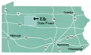
The Bucktail Path Located in the Elk State Forest, in north central Pennsylvania, 35 miles northeast of Clearfield Pennsylvania. The trail is approximately 33 miles long and starts at Sizerville State Park and ends in the village of Sinnemahoning.
The trail is orange blazed. Highlights are mountain vistas, varied terrain, former railroad grades and the Johnson Run Natural Area. The Johnson Run Natural Area is a 200-acre area of old growth hemlock and hardwoods.
The information provided on the left includes detailed maps, GPS tracking files for you to download, photographs taken during the hike, and weather information.
Click here to see photos of the trail.

Highgear and Zinnware at Sizerville Park
The Elk State Forest office at the address below is the source for information. The Elk State Forest Office has a map of the Bucktail Path and can be obtained by contacting the office. You will need a permit if you plan to camp at the same spot more than one night or plan to build a campfire during the high fire seasons.
Forest District Headquarters
Elk State Forest
258 Sizerville Road
Emporium, PA 15834
Phone: 814-486-3353
FD13@state.pa.us